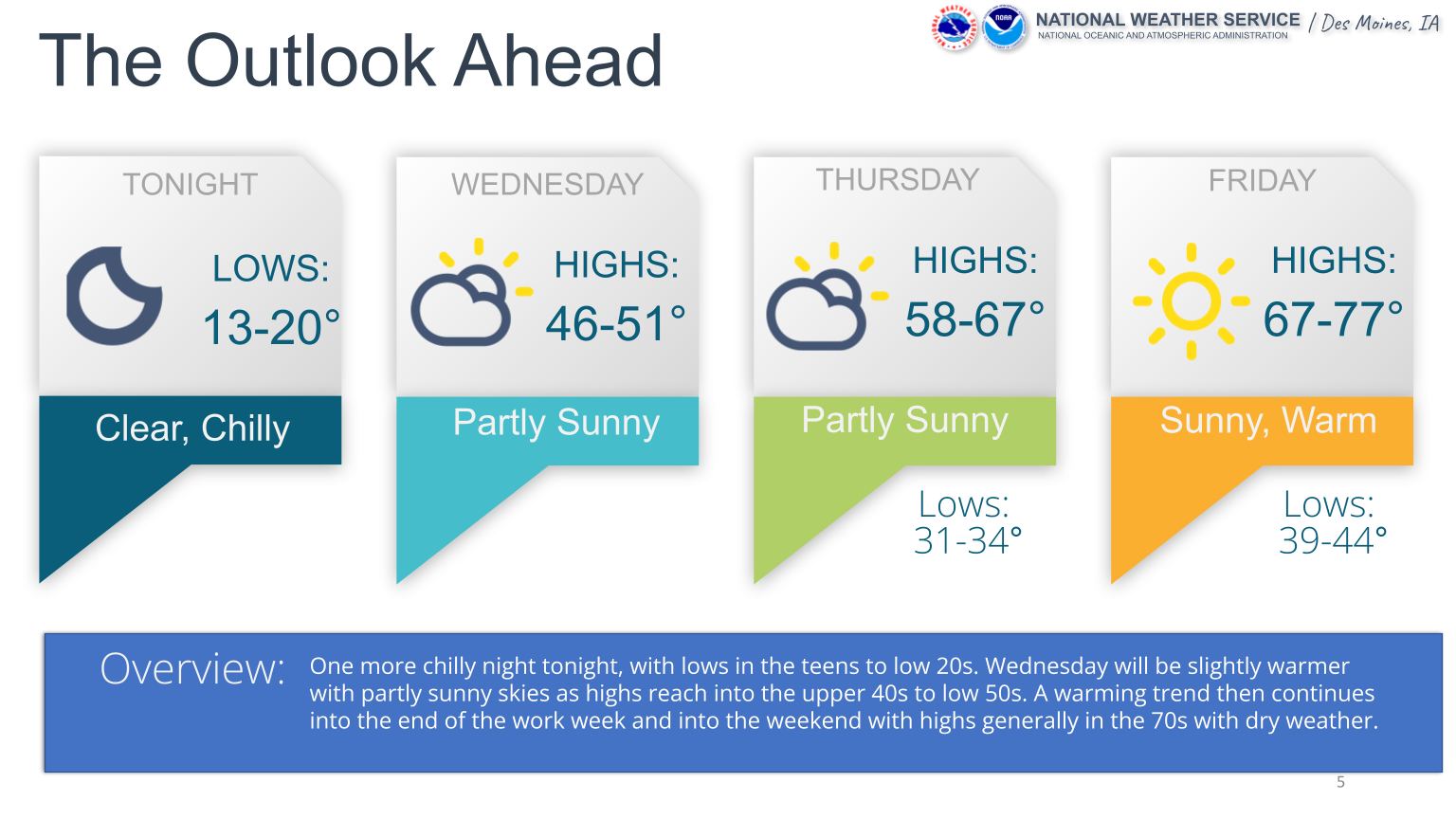
Image courtesy of National Weather Service
Across Iowa this week, there’s been frigid temperatures and by the end of the week, it’ll be back in the shortsleeve weather.
Weatherology Meteorologist Ray Miller explains what was happening in the atmosphere to cause such a cold start to the week.
“Well what we had is, what we call in the winter time, we call an arctic area of high pressure settle in across the region. It’s very cool air mass from the North that is really just kind of settled down over the area and it’s high pressure so it’s blocking any storm systems from coming through and really changing the weather pattern. So it’s fairly persistent, quiet but cool pattern.”
Miller points out that warmer temperatures are ahead once the sun comes fully back out later this week.
“Well, we’re just getting more sunshine and that really is just the difference at this point. The sun still warms the surface and the surface warms the atmosphere fairly effectively this time of year. So when we have several uninterrupted days of sunshine that allows temperatures to gradually warm up. So we go from these highs in the 40s, which is close to what our overnight lows should generally be this time of year, to high temperatures running about ten degrees above average by the time we get to the weekend.”
According to the National Weather Service, daytime highs in the Raccoon Valley Radio area are the mid to upper 70s for this weekend.

