
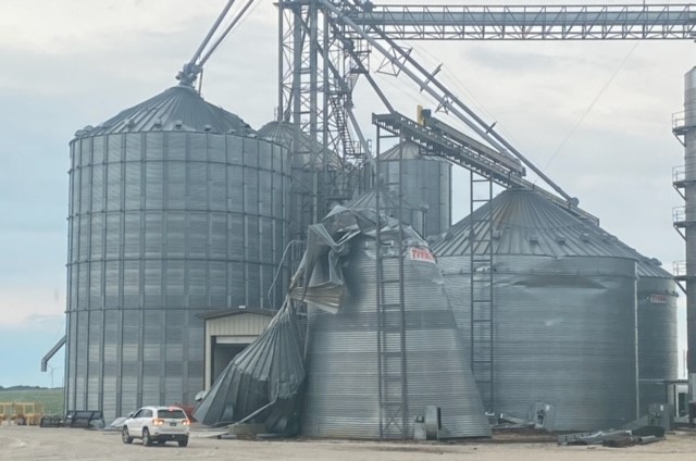
Weather officials are saying the damage that was caused by the early Monday morning thunderstorms in Greene County were due to high winds.
Weatherology Meteorologist Paul Trambley tells Raccoon Valley Radio the peak of the strong winds during the severe thunderstorms warnings that were issued by the National Weather Service from 4-5:30am were upwards of 80 miles per hour near Glidden and sustained 60mph through Greene County, which caused straight line winds.
“Those winds are generated by the strong outflow that develops in these larger bands of these thunderstorms, kind of in the right conditions. The criteria for a severe storm is any winds over 58 miles per hour. That’s kind of the criteria that you generally start to see some sort of damage when you get close to 60 miles per hour wind gusts, whether it be due to some roofing materials, obviously some trees, especially weakened trees or older trees that are more brittle can certainly be taken by those types of winds.” 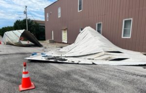
Acting Greene County Emergency Management Coordinator Jack Williams talks about the other major damages that the storm caused.
“There was damage to a couple of buildings on Main Street in Churdan, along with the Churdan school also had some damage. But for the most part just a lot of power lines and trees down, Spring Lake (Park) was hit pretty hard again. We had a couple of campers stuck from trees that fell across their campers. But we did get them out with no injuries.”
The City of Jefferson reminds residents to neatly stack sticks and tree branches in armloads at curbside, along with other yard waste placed in biodegradable bags with stickers. Residents can also deposit those items at the yard waste dump site at Daubendiek Park.