
With expected winter conditions to get worse, the National Weather Service has adjusted its warnings.
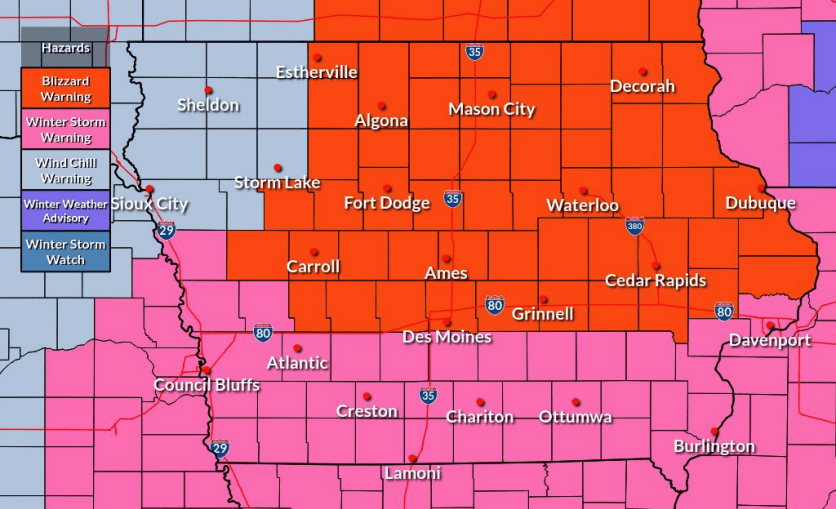
According to the National Weather Service, Greene, Guthrie and Dallas counties will be under a blizzard warning from noon tomorrow through 6am on Saturday. Multiple threats with the storm include 3-6 inches of snowfall, along with very strong winds and bitterly cold temperatures. National Weather Service Meteorologist Allan Curtis tells Raccoon Valley Radio some of the snowfall will begin later today, but the real trouble begins tomorrow with winds gusting as high as 50 miles per hour.
“You can imagine: light, fluffy snow, plus really strong winds is going to combine to basically make us a really big snow globe. But a snow globe that is going to be nearly white out to white out conditions. So think basically, effectively near blizzard to blizzard conditions across large parts of the state, as early as Thursday afternoon and then carrying potentially through much of Friday.”
Curtis talks about the other danger following the snowfall tomorrow, which is the rapidly declining temperatures.
“That’s pretty much rubbing salt into the wound, sorta speak with this entire event. It’s not unusual for Iowa overall in a winter to at least get it (these temperatures) once or twice. But it is unusual this early kind of in the winter season. So Thursday temperatures will be falling throughout the day. Once we get below zero Thursday afternoon, we’re likely to stay below zero until, oh gosh, potentially Saturday morning (or) Saturday afternoon, and that’s just the raw temperature.”
Curtis adds the wind chill could knock down the temperature to as low as 40 degrees below zero through Saturday.