
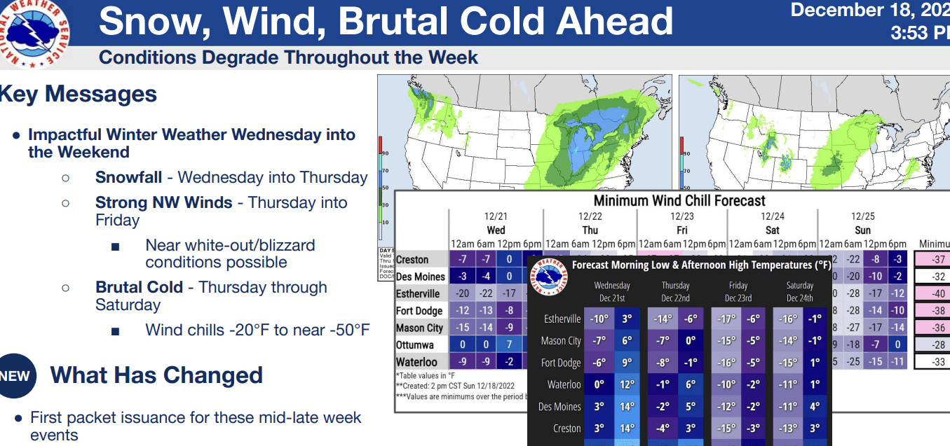
The National Weather Service is predicting a powerful winter storm to hit at the end of the week which may impact travel for the upcoming holiday.
Meteorologist Craig Cogil says they are really focusing on Wednesday afternoon, when they expect the storm to start, and last till Friday. Cogil explains that this storm will bring blizzard-like conditions that could include snow amounts reaching up to eight inches, wind chills from -20 to -40 degrees and 40 to 50 mph wind gusts. He tells Raccoon Valley Radio what’s going to make travel difficult throughout the week.
“I don’t know if snow amounts are really going to matter in this. Once you get those strong winds going, it’s going to loft that snow up into the air and make for very poor visibility, especially out in the rural areas. So regardless of the amount of snow, it’s really the strong winds, and the cold temperatures, and the blowing snow that’s going to really make things treacherous out there.”
Cogil encourages people to take proper precautions before Wednesday afternoon.
“You may want to rethink your travel plans if you’re thinking of traveling Thursday or Friday. It’ll be very difficult across the state of Iowa and actually a good chunk of the Midwest. Certainly, if you’re going to be at home, you probably want to go out by midday Wednesday or later in the day on Wednesday and make sure that you’ve got the groceries that you need.”
He also says that people should limit their time outside to only 15 minute periods because temperatures will be below zero which won’t take long for exposed skin to succumb to frostbite.