
Spring has officially begun, and like clockwork are forecast predictions of severe storms and potential flooding for the Raccoon Valley Radio Network.
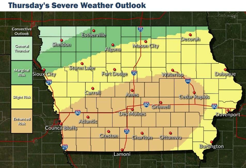
Dallas, Greene, and Guthrie counties all fall under an enhanced risk for severe weather today, with damaging winds and an isolated tornado likely, according to the National Weather Service. Moderate to heavy rainfall over the week may push a few rivers into flooding by the weekend, which follows the final spring flood outlook that was released by the National Weather Service. This is the third report given this year, which Adair and Guthrie County Emergency Management Deputy Coordinator Jeremy Cooper says the agency has reviewed and discussed with fellow agencies since February, “They’re looking through the springtime and they take all the things in account with the snowpack, moisture levels, the soil, and everything. So with that then early on that outlook was looking promising to us having flooding in our area. The river levels and stream levels were above normal. You drive around Guthrie and Adair county now and the rivers and streams are running normal or below normal, so as this has progressed through our outlook looks better and better.”
Cooper mentions that the report isn’t as promising for Iowans near the Mississippi and Missouri rivers as the flood risk there is well above normal. The final outlook states that the risk of minor flooding is generally near-to-above normal, and the risk of moderate and major flooding is near normal at all locations. This fares better than last spring, which put the state at an above normal risk, which could be attributed to below normal and nonexistent levels of snowpack currently across the state.