
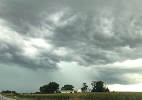
Thunderstorms were felt in Greene, Dallas and Guthrie counties Saturday afternoon and through the overnight, which triggered Raccoon Valley Radio’s Severe Weather Action Team coverage.
Several severe thunderstorm warnings were issued by the National Weather Service for all three counties. The first two were issued for the southwestern and northwestern portions of Guthrie County on Saturday at 12:45pm and 12:46pm respectively. The lone severe weather threat was up to quarter-size hail, which was radar indicated. Adair and Guthrie County Emergency Management Coordinator Bob Kempf reported heavy rainfall. The warnings were then allowed to expire at 1:15pm.
The second set of thunderstorm warnings were issued at 2:50pm for northern Dallas County and at 2:52pm the warning was for east central Greene County. Dallas County Emergency Management Coordinator A.J. Seely reported one-inch diameter of hail and Greene County Dispatch confirmed pea to dime-size hail by the Jefferson Police Officer. Both warnings expired at 3:15pm.
Another round of a severe thunderstorm warning was issued at 4:26pm for central Greene County. Strong winds and heavy rainfall developed in the northern half, with confirmed report of one-inch in diameter hail five miles south of Churdan. The warning then expired at 4:45pm. The final thunderstorm warning was issued at 12:29am Sunday and expired at 1am for northwestern Guthrie County. The main threats with the warning were 60-miles-per-hour wind gusts and up to a half-dollar-sized hail, which were radar indicated.
Through all of the warnings, there were no immediate reports of damage.
Four Raccoon Valley Radio staff, along with Kempf, Seely, Greene County Dispatch, Greene County Emergency Management Coordinator Dennis Morlan, and a listener provided live coverage of the severe storms. The one to count on for severe weather coverage is the Raccoon Valley Radio Network.