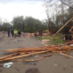
 Damage survey results have come in from the National Weather Service in Des Moines regarding Sunday night’s tornado event in Guthrie County.
According to NWS, “a line of thunderstorms produced at least one tornado that tracked south of Guthrie Center and across Lake Panorama” between 9:43 and 10:08 Sunday night.
The tornado has been classified as an EF-2.
The tornado’s estimated peak wind hit 115 miles per hour, while its path length has been estimated at 16.7 miles. Its path width is estimated at 100 yards.
NWS has listed the tornado’s starting point as being 4.5 miles south of Guthrie Center. The tornado then continued tracking northeast before it eventually dissipated northeast of Yale. 
NWS says it is currently surveying two more possible tornadoes–one near Lake Panorama and the other near Dallas Center. Those survey results are expected to be released sometime later today.
All statements from the National Weather Service are subject to change pending final review of events and publication in NWS storm data.
Raccoon Valley Radio will continue to bring you more information about Sunday’s Guthrie County tornado as it becomes official.

